SolveItClass 9 · NCERT

NCERT Solutions · Class 9 Social Science Shaping of the Earth’s Surface

30 questions · 30 still being checked

The Big Questions 2.1–2.5 (part 1 of 6)

  1. Exercise 2.1

    What shapes the Earth’s surface?

    The book prints no answer for this

    NCERT publishes no answers for this textbook, so there is nothing in the book to check this working against. It has also not yet been read through by hand.

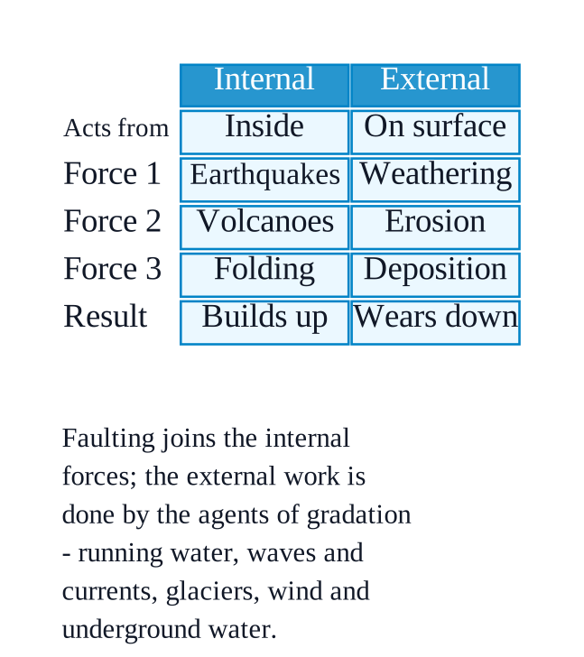
    Two sets of forces shape the Earth's surface: internal forces working inside the planet and external forces working on top of it.
    NCERT_Solution_Class9_SocialScience_Ch2_BQ_Q2-1
    Internal forces — earthquakes, volcanic eruptions, folding and faulting — build up mountains, valleys and ocean basins.
    The big idea behind the internal forces is plate tectonics: the Earth's outer layer is broken into plates that move slowly over the semi-molten mantle below.
    External forces — weathering, erosion and deposition — slowly wear those features down and reshape them.
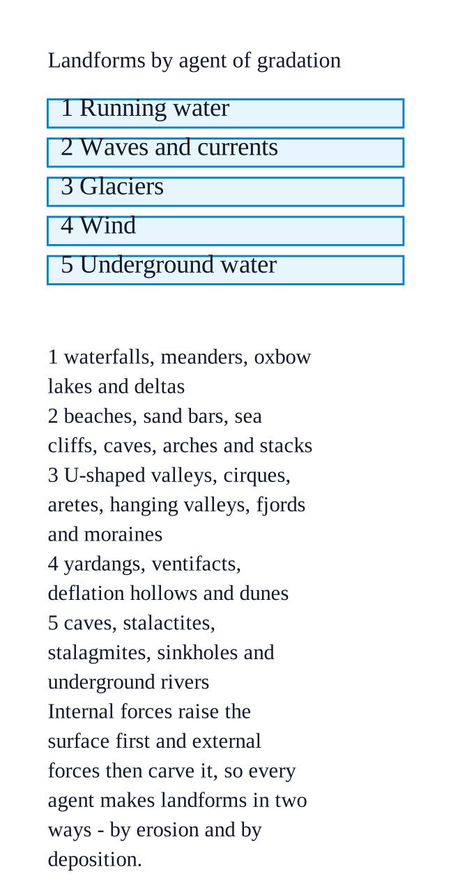
    The external work is done by agents of gradation: running water, waves and currents, glaciers, wind and underground water.
  2. Exercise 2.2

    What is plate tectonics? What are the effects of plate movement?

    The book prints no answer for this

    NCERT publishes no answers for this textbook, so there is nothing in the book to check this working against. It has also not yet been read through by hand.

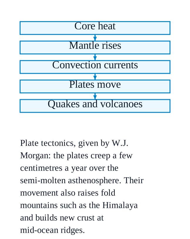
    Plate tectonics is the theory, given by W.J. Morgan, that the Earth's outermost layer is not one piece but is broken into large and small pieces called tectonic plates.
    NCERT_Solution_Class9_SocialScience_Ch2_BQ_Q2-2
    The plates are massive slabs of solid rock. They move only a few centimetres a year, sliding over the semi-molten asthenosphere.
    They are pushed and pulled by convection currents in the mantle, driven by heat from the Earth's core.
    Effects of the movement: fold mountains such as the Himalaya, new crust and mid-ocean ridges such as the Mid-Atlantic Ridge, ocean basins, volcanoes and earthquakes.
    Most earthquakes and volcanoes occur along plate boundaries, especially around the Pacific Ocean — the Ring of Fire. The theory also explains where the continents and oceans lie.
  3. Exercise 2.3

    How are landforms formed and how are they classified?

    The book prints no answer for this

    NCERT publishes no answers for this textbook, so there is nothing in the book to check this working against. It has also not yet been read through by hand.

    A landform is a natural feature on the Earth's surface, formed by weathering, erosion, deposition and the movement of the Earth's crust.
    NCERT_Solution_Class9_SocialScience_Ch2_BQ_Q2-3
    Formation happens in two stages: internal forces raise the surface (plate collision, volcanoes, folding, faulting), then external forces carve it.
    The chapter classifies landforms by the agent of gradation that made them — running water, waves and currents, glaciers, wind, and underground water.
    Each agent works in two ways, so landforms are also of two kinds: those made by erosion and those made by deposition.
    Examples: waterfalls, meanders and deltas (running water); beaches, sea cliffs, arches and stacks (waves); U-shaped valleys, cirques and moraines (glaciers); yardangs and dunes (wind); caves, stalactites and sinkholes (underground water).
  4. Exercise 2.4

    How are humans and other living beings connected to these landforms?

    The book prints no answer for this

    NCERT publishes no answers for this textbook, so there is nothing in the book to check this working against. It has also not yet been read through by hand.

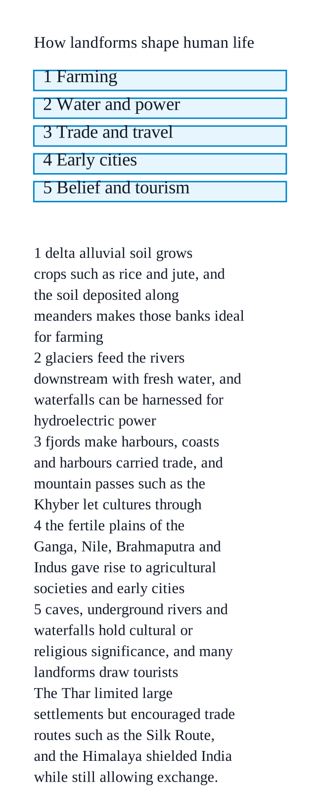
    Landforms decide where people live, farm, trade and travel.
    NCERT_Solution_Class9_SocialScience_Ch2_BQ_Q2-4
    Fertile land comes from landforms: deltas have rich alluvial soil and grow crops such as rice and jute, and the soil deposited along meanders makes those banks ideal for farming.
    Landforms provide water, power and work — glaciers feed rivers with fresh water, waterfalls can be used for hydroelectric power, fjords make harbours, and the mixing of fresh and saltwater in deltas creates diverse aquatic life for fishing.
    History was shaped by them: the plains of the Ganga, Nile, Brahmaputra and Indus gave rise to early cities; the Himalayas shielded India yet allowed exchange through passes like the Khyber pass; the Thar limited settlement but encouraged trade routes such as the Silk Route.
    Some landforms — caves, underground rivers, waterfalls — also carry cultural or religious significance, and many draw tourists.
  5. Exercise 2.5

    How do disasters associated with different landforms impact human lives?

    The book prints no answer for this

    NCERT publishes no answers for this textbook, so there is nothing in the book to check this working against. It has also not yet been read through by hand.

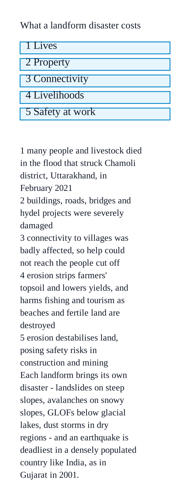
    They cost lives, livestock and property, and cut people off from help.
    NCERT_Solution_Class9_SocialScience_Ch2_BQ_Q2-5
    The chapter's example: the flood in Chamoli district, Uttarakhand, in February $\displaystyle 2021$ killed people and livestock, damaged buildings, roads, bridges and hydel projects, and badly affected connectivity to villages.
    Each landform brings its own disaster — landslides on steep slopes, avalanches on snowy mountain slopes, GLOFs below glacial lakes, and dust storms in dry, sparsely vegetated regions.
    Earthquakes are especially deadly in a densely populated country like India; the chapter shows the extensive damage of the $\displaystyle 2001$ Gujarat earthquake.
    Slower damage also hurts: erosion strips farmers' topsoil and lowers yields, washes away houses and roads near rivers and coasts, makes mining and construction unsafe, and harms tourism and fishing.